iFlood is a partnership between researchers at the Woods Hole Oceanographic Institution, the town of Nags Head, and the town of Duck to improve flooding predictions along the North Carolina Outer Banks.
Did you Know?
- Citizen-scientist flood reports submitted by you provide our research team with data about the location and timing of flooding events.
- These reports help evaluate and improve models for flooding owing to ocean storms and rainfall.
- If successful our model will be applied to help manage flooding hazards for the Outer Banks.
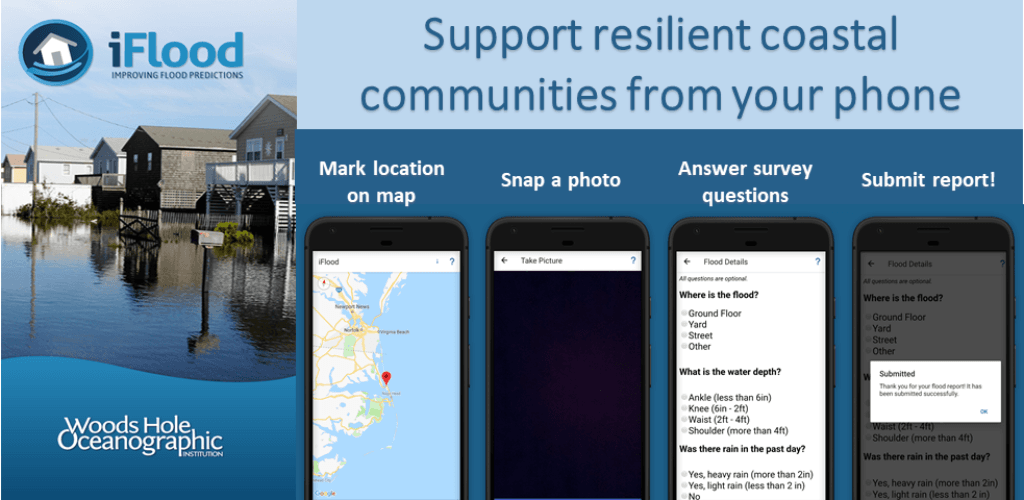
Download the App today from the App Store or Google Play!
Funding for this project was provided by the US Coastal Research Program. Images used in the app graphics were provided by the U.S. Army Corps of Engineers Field Research Facility.